
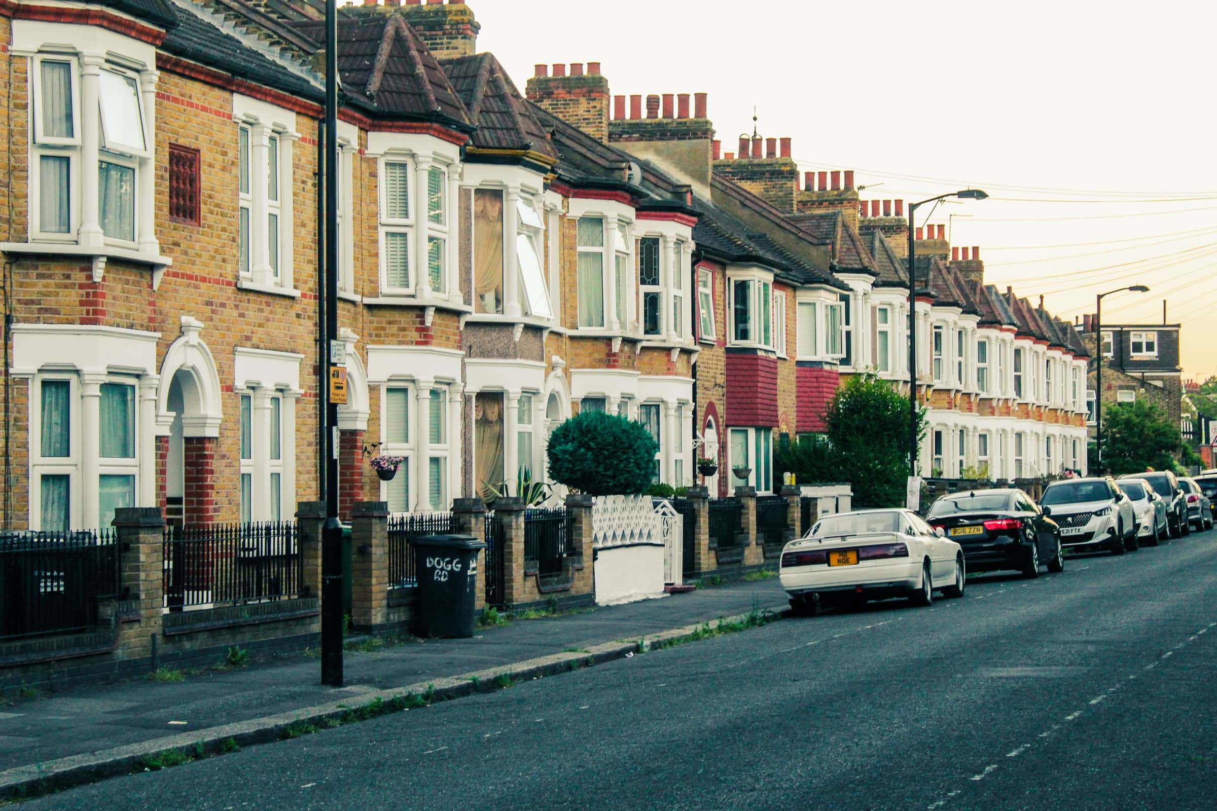
Residential surveyor in Hackney
Hackney’s E8 and E9 postcodes run from the streets around London Fields and Broadway Market, through the early and mid nineteenth century houses of the Graham Road and Mapledene conservation area, to the terraces facing Victoria Park and the canalside industrial buildings of Hackney Wick. The area is in the London Borough of Hackney.
Level 2 from £649, Level 2 Plus from £849, Level 3 from £895, including all taxes and fees.
- E8
- E9
Local property context
What matters when surveying in Hackney
Hackney buyers are usually choosing between a Victorian or earlier terrace, a flat in a converted house, a flat in a converted industrial building around Hackney Wick, or a flat in a newer block. Many houses here have been divided, extended and re-roofed over a long period, so the survey needs to separate the condition of the original building from the quality and approval of later work, and to read the shared parts as carefully as the flat itself.
A Level 2 Plus suits most conversion flats and terraces in decent order, because it explains construction and the shared parts that could be seen. A Level 3 is the better choice for a whole early or mid nineteenth century house, a house with basement or loft works, or a flat in a converted industrial building where old and new structure are mixed. A Level 2 can suit a flat in a newer, well-managed block.
Local knowledge for Hackney buyers
Hackney has 35 conservation areas. Graham Road and Mapledene, designated in 1997, is the borough’s largest and is made up largely of early to mid nineteenth century housing, with some Georgian buildings on Dalston Lane. Broadway Market, designated in 1995, follows an old route used to carry produce from Hackney’s fields to the City markets, and the early to mid nineteenth century linked pairs of houses on Dericote and Croston Streets are Grade II listed.
Victoria Park was laid out in the early 1840s to a plan by James Pennethorne. Hackney’s Victoria Park conservation area, first designated in 1977 and extended in 1994 and 2013, covers most of the historic buildings fronting the park and Well Street Common. The surrounding streets are largely nineteenth century terraces in stock brick with slate roofs, where roofs, rear additions and the way a house has been divided are the usual questions.
Hackney Wick became a conservation area in 2009 to protect its industrial buildings, yards and waterside setting on the Lee Navigation, and it was extended in 2014. Planning there was handled by the London Legacy Development Corporation from 2012 until powers returned to Hackney from 1 December 2024. Land beside the Lee is within the Isle of Dogs and Lea Valley flood policy area, and converted industrial buildings often combine old brick and steel with newer floors and partitions.
Property types in the area
- Early and mid nineteenth century terraces and linked pairs
- Victorian terraced houses
- Houses converted into flats
- Canalside warehouse and industrial conversions
- Post-war council estates
- Modern apartment blocks near the Olympic Park
Condition themes to consider
These are prompts for inspection, not a prediction that a particular home has a defect.
- Conservation area consent for past alterations
- Standard and approval of flat conversions
- Clay-related movement near street trees
- Mixed construction in converted industrial buildings
- Flood risk near the Lee Navigation
- Roofs and rear additions on older terraces
Before exchange of contracts
- Ask the conveyancer for building regulations approval for the conversion and any loft or rear extension.
- Check whether the property is in a conservation area, and whether replacement windows or roof changes had permission.
- For a Hackney Wick flat, ask which authority granted the consents and check the long term flood risk on GOV.UK.
- Point out any cracking near bay windows or street trees you noticed on a viewing.
Hackney survey questions
- Who holds the planning records for a Hackney Wick property?
- It depends on when the work was approved. The London Legacy Development Corporation handled planning at Hackney Wick from 2012 until powers returned to Hackney from 1 December 2024, so older consents may sit in its records. JBS Surveying notes visible alterations, and your conveyancer can check which body approved them.
- Which survey do I need for a property in Hackney?
- A Level 2 Plus suits most conversion flats and terraces in decent order, because it explains construction and the shared parts that could be seen. A Level 3 is the better choice for a whole early or mid nineteenth century house, a house with basement or loft works, or a flat in a converted industrial building where old and new structure are mixed. A Level 2 can suit a flat in a newer, well-managed block.
- How much does a home survey cost in Hackney?
- For homes up to £500,000, JBS Surveying charges from £649 for a Level 2, £849 for a Level 2 Plus and £895 for a Level 3, including all taxes and fees. Fees rise in steps with the property’s price, so we confirm the exact fee in writing once we know the price and the property.
- What problems do surveyors often find in Hackney homes?
- Common themes in Hackney include conservation area consent for past alterations, standard and approval of flat conversions, clay-related movement near street trees and mixed construction in converted industrial buildings. These are prompts for the inspection, not a prediction that a particular home has a defect; the report rates each part of the property and says what to do next.
- Is Hackney at risk of subsidence or flooding?
- Much of east London sits on London Clay or on Thames and Lea river terrace gravels, with lower-lying land near the Thames and the River Lea, so ground type and flood risk both vary from street to street. Ground conditions vary street by street: the British Geological Survey GeoIndex shows the geology for an address, and the Environment Agency’s long term flood risk service shows the flood risk for the postcode. The survey reports any signs of movement or damp it finds and when to involve a structural engineer or insurer.
- Do you cover E8 and E9?
- Yes. JBS Surveying is based in Queen’s Park, NW6, and surveys homes in Hackney (E8 and E9) and across London. Joe Weaver, AssocRICS, RICS Registered Valuer and MRPSA, inspects every property and writes every report. Level 2 and Level 2 Plus reports are typically issued within 5 working days of the inspection and Level 3 reports within 7.
Hackney survey enquiries
Tell us about the property before you choose
Send the Hackney postcode, sales particulars and any concerns you already have. JBS will confirm coverage and explain which survey level appears proportionate before you book.
Official guidance and further reading
These independent sources explain the wider professional, legal and maintenance context. They do not replace advice about the particular property or its title.
- Hackney CouncilGraham Road and Mapledene conservation areaHackney’s largest conservation area, designated in 1997, made up largely of early to mid nineteenth century housing.
- Hackney CouncilBroadway Market conservation areaThe historic market route and the listed early to mid nineteenth century houses on Dericote and Croston Streets.
- Hackney CouncilHackney Wick conservation areaDesignated in 2009 to protect historic industrial buildings and waterside character on the Lee Navigation, and extended in 2014.
- GOV.UKCheck your long term flood riskEnvironment Agency flood risk from rivers, the sea, surface water and reservoirs for any address.
- RICSHouse surveys: the costs, types and benefits of oneHow property age, condition and complexity influence the appropriate level of home survey.
- GOV.UKHow to buy a homeGovernment guidance on surveys, legal work and the wider home-buying process in England and Wales.
- GOV.UKBuying or owning a leasehold homeAn explanation of leasehold ownership, responsibilities, service charges and permissions.
Survey options in Hackney
All three follow the RICS Home Survey Standard and use the same condition ratings. The difference is how much the report explains, and all three are available in Hackney.
Level 2 Home Survey
Conventional houses and flats in reasonable condition
from £649
Report typically 5 working days after the inspection
Level 2 Plus Home Survey
Converted, period or higher-value flats, and well-kept homes where you want more explanation
from £849
Report typically 5 working days after the inspection
Level 3 Building Survey
Older, larger, altered or unusual properties, or where you plan significant work
from £895
Report typically 7 working days after the inspection
Valuations from £325. See valuations
Neighbouring areas we cover
East London
Bethnal Green
Bethnal Green lies just east of Shoreditch and the City, between Hackney Road and Mile End. Its housing includes the London County Council’s Boundary Estate of the 1890s, two-storey Victorian terraces on the Jesus Hospital Estate near Columbia Road, terraces near Victoria Park and the Regent’s Canal, and many post-war council estates. Bethnal Green is in Tower Hamlets.
View area guidanceNorth London
Stoke Newington
Stoke Newington combines Georgian houses on and around Church Street and Clissold Park with long streets of mid and late Victorian terraces, many now flats. Much of the older housing is in Hackney conservation areas.
View area guidanceEast London
Bow
Bow grew where the old road to Essex crossed the River Lea, and its first bridges gave the place its name. Housing in E3 includes the formal terraces built around Tredegar Square between about 1820 and 1860, streets of later Victorian terraces around Driffield Road and Roman Road, the former Bryant and May match works now known as the Bow Quarter, and large post-war estates. Bow is in Tower Hamlets.
View area guidanceNorth London
Islington
Islington offers some of the finest Georgian and early Victorian terraced housing in London, alongside later Victorian streets, post-war estates and modern developments. The area's conservation areas and listed buildings add an additional layer of complexity for buyers seeking detailed property advice.
View area guidanceEast London
Leyton
Leyton was rural until the railways and industry arrived in the mid nineteenth century, and its population rose from under 5,000 in 1861 to nearly 99,000 by 1901. Most of E10 is streets of late Victorian and Edwardian terraces, with shopping parades along the High Road and around the Bakers Arms and the Lea Valley to the west. Leyton is in Waltham Forest.
View area guidanceEast London
East London
The E postcodes run from the early Georgian streets of Spitalfields and the riverside warehouses of Wapping, through the Victorian suburbs of Hackney, Bow, Leyton and Walthamstow, to the former docks of the Isle of Dogs and the Lea Valley around Stratford and the Olympic Park. Most of the area falls within Tower Hamlets, Hackney, Newham and Waltham Forest, with Wanstead in Redbridge.
View area guidance